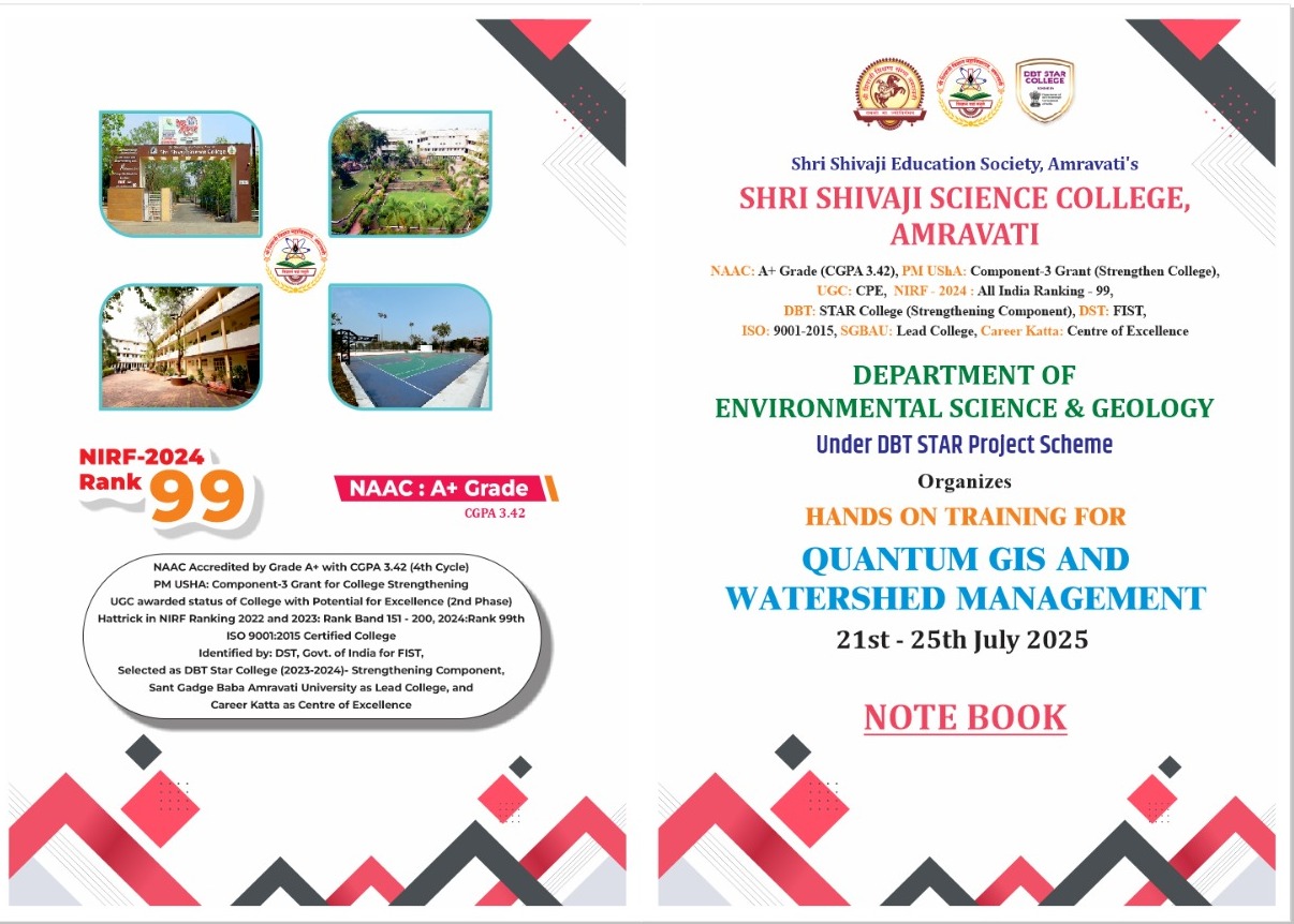
SHRI SHIVAJI SCIENCE COLLEGE, AMRAVATI
DBT STAR COLLEGE PROJECT ACTIVITY
ACTIVITY REPORT
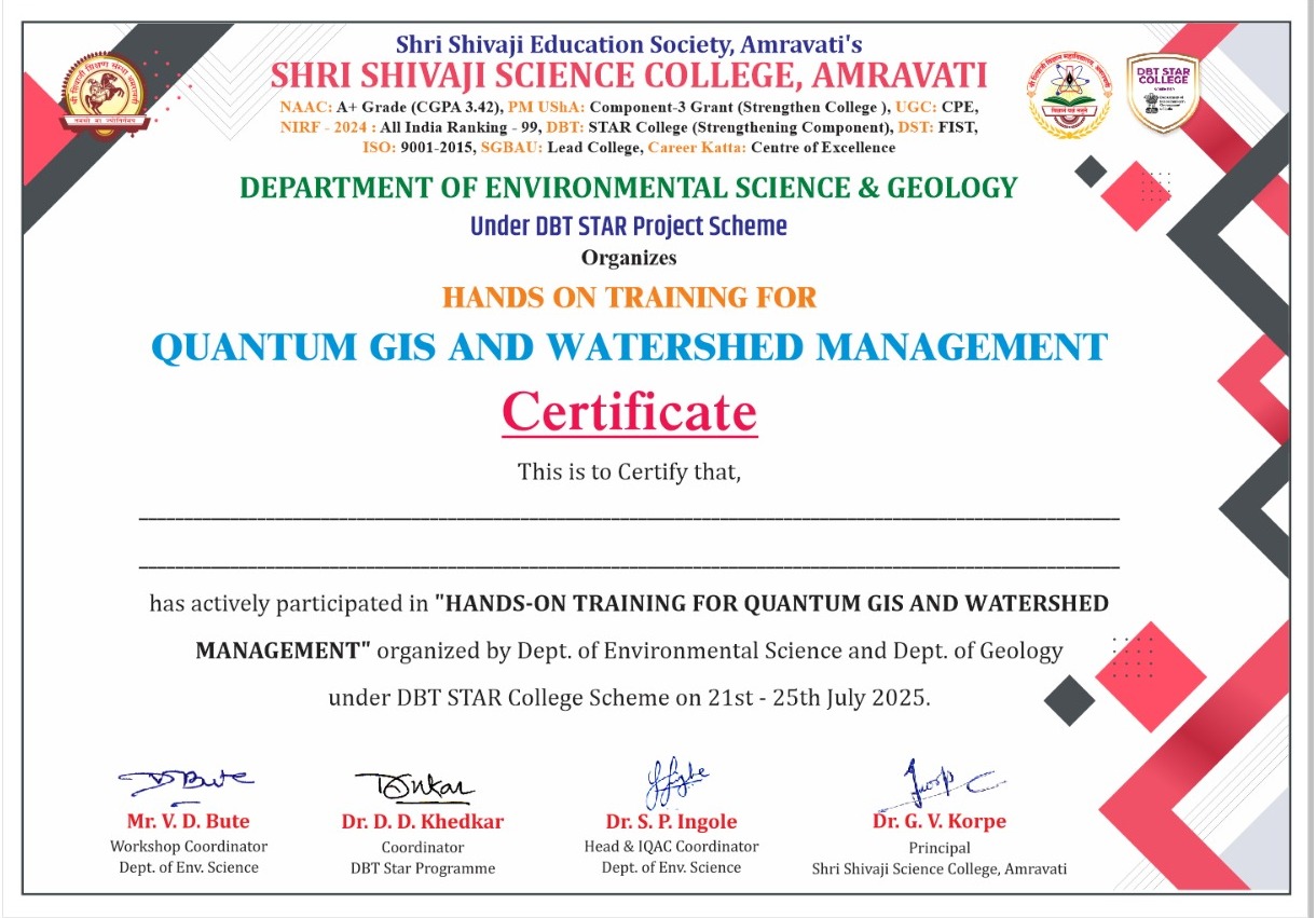
Hands-on Training for Quantum GIS and Watershed Management
Activity Dates: 21st to 25th July 2025
Type of Activity: Students Workshop
Organizing Department: Department of Botany & Bioinformatics
Program Coordinators: Mr. V. D. Bute
Head of the Department: Dr. S. P. Ingole
External Collaborator (if any): Geotech GIS Training Institute and Consultancy Services, Chhatrapati Sambhaji Nagar & Department of Geology, Shri Shivaji Science College, Amravati
Objectives:
- o Provide foundational understanding of GIS and its environmental applications.
- o Train students in the use of open-source QGIS tools for spatial data visualization, editing, and analysis.
- o Introduce the concepts and significance of watershed and its management practices.
- o Enable students to analysed and interpret watershed-related spatial data for sustainable planning.
- o Develop student competency in applying GIS techniques for real-world environmental problem-solving.
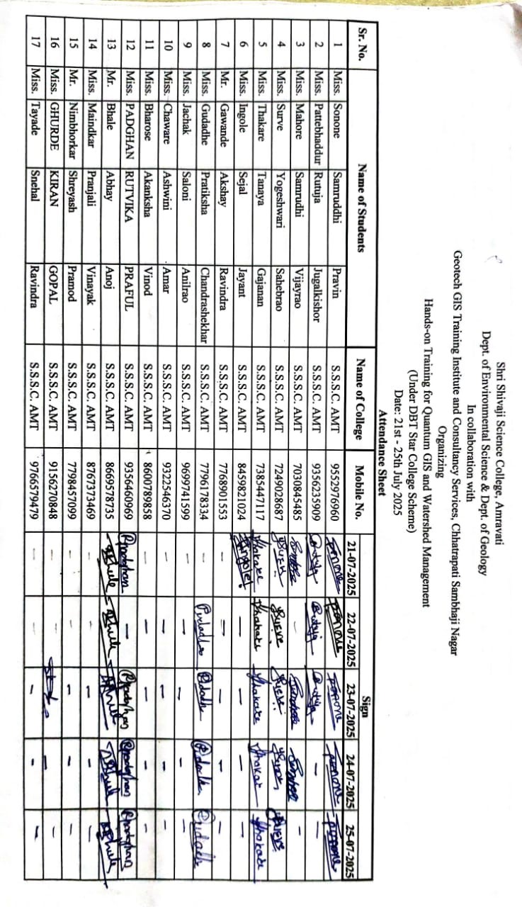
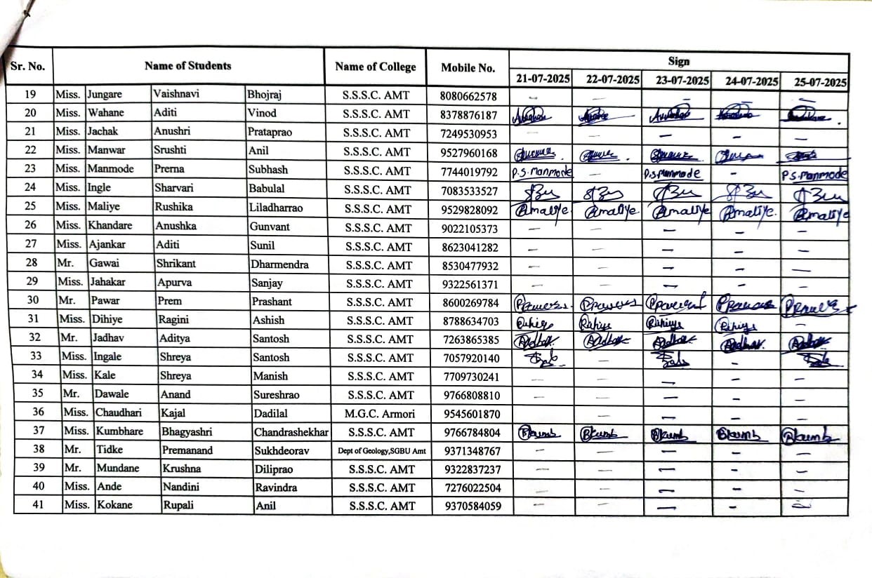
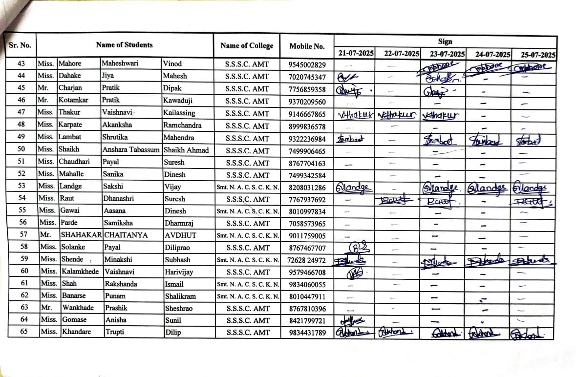
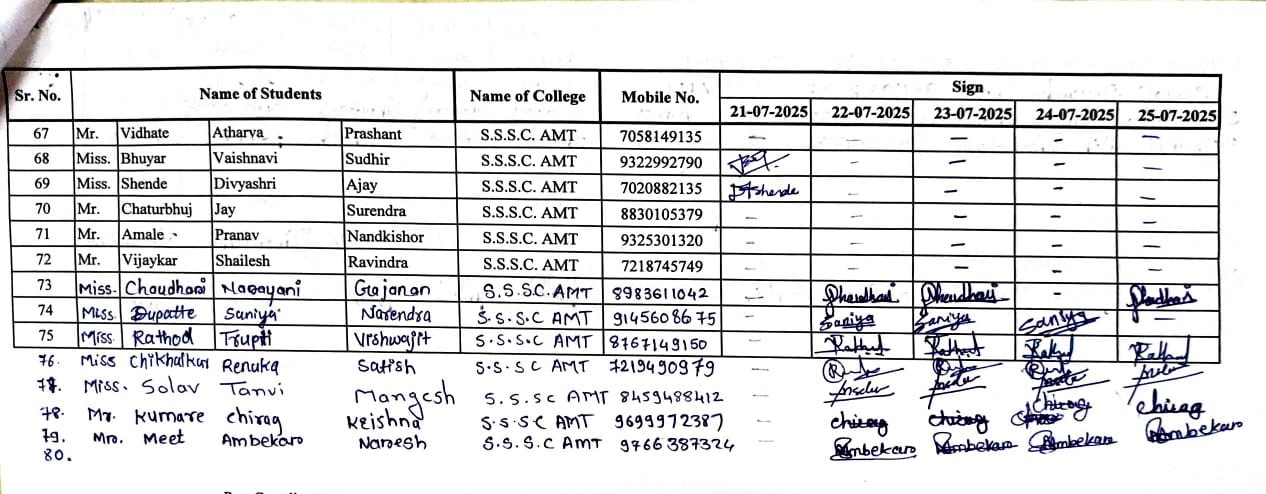
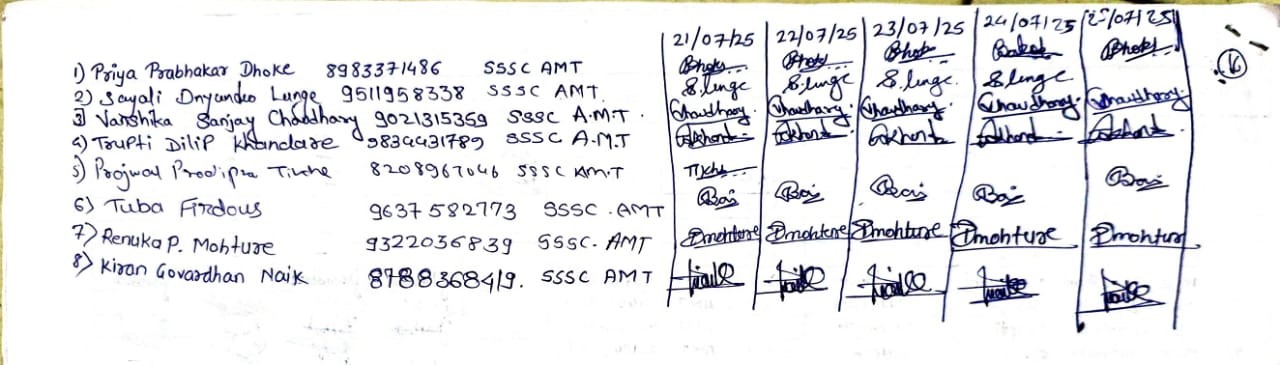
No of Beneficieries: 46
Classes Involved: UG & PG Environmental Science
Venue of the Activity: Shri Shivaji Science College, Amravati
Activity Report:
The Department of Environmental Science and Department of Geology, Shri Shivaji Science College, Amravati, jointly organized a five-day Hands-on Training Programme on Quantum GIS and Watershed Management from 21st to 25th July 2025. This interdisciplinary training was organized under the DBT STAR College Scheme and in academic collaboration with Geotech GIS Training Institute and Consultancy Services, Chhatrapati Sambhaji Nagar. The primary goal of the program was to introduce students to Geographic Information System (GIS) technology using open-source Quantum GIS (QGIS) software and demonstrate its application in watershed analysis and management.
The program commenced with an inaugural ceremony, which witnessed the gracious presence of several distinguished dignitaries. Dr. S. P. Ingole, Head and IQAC Coordinator, Department of Environmental Science, inaugurated the training and welcomed the guests and participants. He emphasized the growing significance of geospatial tools in environmental studies and water resource management. His remarks focused on how integrating modern technology like QGIS with field knowledge can drive sustainable development strategies. Dr. D. D. Khedkar, Head of the Department of Botany and Coordinator of the DBT STAR College Scheme, addressed the audience and highlighted how this training aligns with the objectives of the STAR Scheme by fostering skill development and interdisciplinary learning. Dr. M. M. Deshmukh, Head of the Department of Geology, also delivered an insightful address focusing on geological perspectives in watershed mapping and terrain interpretation.
The keynote address was delivered by Dr. Vikas D. Ghadamode, Director, Geotech GIS Training Institute, Chhatrapati Sambhaji Nagar. He elaborated on the practical applications of QGIS and emphasized the importance of developing GIS expertise among undergraduate students. The role of GIS in modern hydrological modeling and sustainable watershed development was also discussed. Mr. Vikrant Bute, Programme Coordinator, played a key role in planning and coordinating the entire training programme and ensured its smooth execution. Mr. S. K. Paunikar, Assistant Professor, Department of Geology, contributed as the Co-coordinator, actively supporting the day-to-day organization and management of the sessions.
A total of 81 students registered for the training program, including 46 students from Shri Shivaji Science College, Amravati, and others from various colleges across the region. The mix of participants created a collaborative and enthusiastic learning environment. Students were eager to explore QGIS and understand its applications in real-world watershed and environmental management.
Day-Wise Session Summary
Day 1 – 21st July 2025
Topic: Introduction to GIS and QGIS Interface
The training began with an overview of Geographic Information Systems (GIS) and its evolution over time. The resource persons explained key terminologies and concepts including spatial and non-spatial data, vector and raster data formats, and map projections.
Participants were introduced to Quantum GIS (QGIS), its features, interface, and capabilities. The trainers guided students through the installation process, navigation of toolbars, and customization of the working environment. Participants learned how to open, explore, and visualize shapefiles and raster layers using sample data.
The hands-on session involved importing base maps, exploring attribute tables, and basic layout configuration.
Day 2 – 22nd July 2025
Topic: Vector Data Handling, Georeferencing, and Map Digitization
On the second day, students explored vector data structures in greater detail, including points, lines, and polygons. The session covered data editing, creation of new shapefiles, and assigning attributes to features.
The georeferencing module introduced students to referencing scanned topographic maps using control points. The process of aligning maps with real-world coordinate systems using reference layers was demonstrated step-by-step.
Practical exercises were conducted on map digitization, where students practiced creating layers representing features like roads, rivers, and land parcels. Techniques like snapping, editing vertices, and topology rules were taught in detail.
Day 3 – 23rd July 2025
Topic: Understanding DEM and Introduction to Watershed Concepts
The third day focused on hydrological applications of GIS. Students were introduced to Digital Elevation Models (DEM) and their role in terrain analysis.
Basic hydrological terms such as watersheds, catchments, drainage basins, flow direction, and flow accumulation were explained. Students explored DEM data and learned to derive slope, aspect, and hillshade layers using QGIS raster analysis tools.
Using plugins like GRASS and SAGA in QGIS, the trainers demonstrated terrain modeling. The hands-on component included loading DEM files, generating slope maps, and interpreting elevation data.
Day 4 – 24th July 2025
Topic: Watershed Delineation and Drainage Analysis
This was the core technical day focused on watershed delineation using QGIS tools. Students were guided through the step-by-step process of extracting watersheds from DEM data.
Topics covered included:
Filling sinks in the DEM
Creating flow direction and flow accumulation grids
Stream extraction and network generation
Identification of pour points and delineation of sub-watersheds
Participants successfully used the r.watershed and r.stream.extract tools in QGIS to produce their own drainage maps and watershed boundaries. The hands-on experience allowed them to simulate real-world analysis and understand terrain-water interactions.
Day 5 – 25th July 2025
Topic: Project Work, Map Layout Design, and Valedictory Session
The final day was reserved for project-based learning. Students were divided into small groups and assigned datasets to perform watershed analysis. Each group worked independently to apply the skills learned throughout the training. They delineated watersheds, generated flow direction and accumulation maps, and prepared layouts using QGIS's Print Layout Manager. Emphasis was placed on map elements such as legends, scale bars, north arrows, and proper labeling. Each group presented their work briefly, showcasing their results and explaining the steps followed in their analysis. Trainers offered constructive feedback and suggestions for improvement. This session boosted their confidence and encouraged them to explore further applications.
The training concluded with a valedictory ceremony, where all participants were appreciated for their commitment and performance. Certificates were distributed to all participants by the dignitaries and resource persons. Dr. Aniket R. Borgawkar, Director, GIS Technology Pvt. Ltd., Chhatrapati Sambhaji Nagar, and Dr. Vikas D. Ghadamode, Director, Geotech GIS Training Institute, were present to congratulate the students and motivate them to continue learning and exploring the field of GIS. Their technical sessions throughout the five days were instrumental in simplifying complex concepts and inspiring students to look at GIS as a powerful tool in environmental sciences. Mr. S. K. Paunikar, Co-coordinator, was also acknowledged for his behind-the-scenes efforts in managing logistics, data setup, and smooth conduct of the practical sessions.
The five-day Hands-on Training on Quantum GIS and Watershed Management was a highly enriching academic experience for the participants. It bridged the gap between theoretical learning and practical application, empowering students to independently carry out geospatial analysis relevant to their fields. The training demonstrated the value of integrating technology into environmental and geological education and opened pathways for further learning and research.
Outcomes:
- • Understand the core concepts of GIS and remote sensing with specific application to watershed management.
- • Demonstrate proficiency in using QGIS software for creating, editing, and analyzing spatial data layers.
- • Identify and delineate watershed boundaries using digital elevation models (DEMs) and relevant geospatial tools.
- • Apply spatial analysis techniques for assessing watershed characteristics such as drainage patterns, slope, and land use.
- • Interpret and visualize geospatial data for effective communication and decision-making in environmental planning.
Photos:
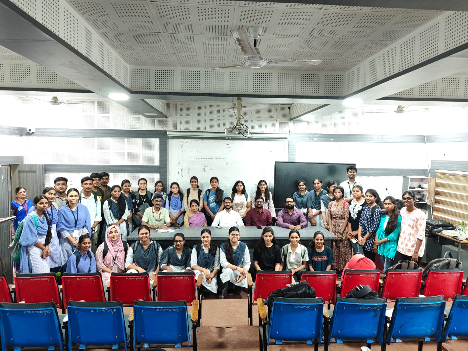 Group photo with faculty and students | 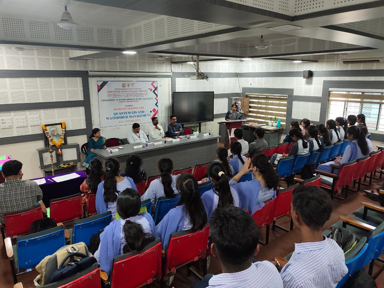 Dr. S. P. Ingole guide students during inougral function |
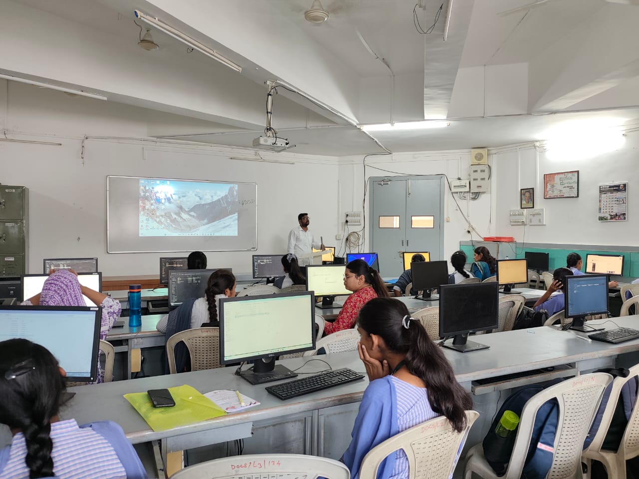 Dr. Vikas D. Ghadamode conducting practical session |  Felicitation of Dr. Aniket R. Borgawkar, Sir |
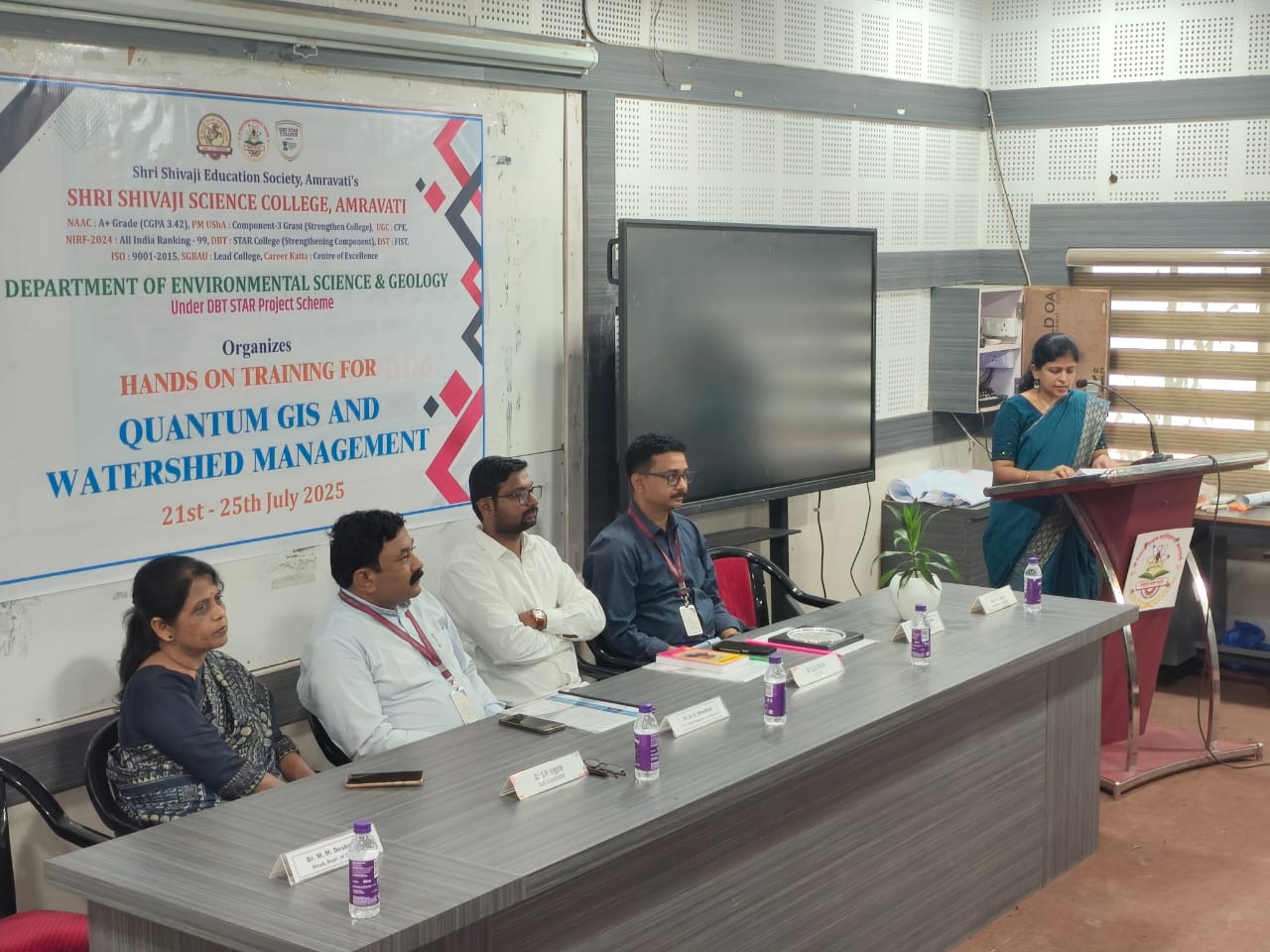 Inaugural fuction of workshop (2) | 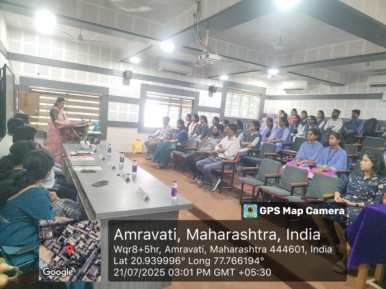 Inaugural fuction of workshop |
Attendance Sheet:
 |
 |
 |
 |
 |
 |
 |
 |